What is FRM for Altimetry?
The European Space Agency (ESA) defines Fiducial Reference Measurements (FRM) as:
“The suite of independent ground measurements that provide the maximum Return On Investment for a satellite mission by delivering, to users, the required confidence in data products, in the form of independent validation results and satellite measurement uncertainty estimation, over the entire end-to-end duration of a satellite mission”.
The FRM Strategy for Earth Observation is ESA’s effort to reach:
- Uniform & Absolute Standardization of Earth observation;
- Credible Estimation of Uncertainty on Metrology standards.
Why need FRM now?
To achieve long-term, consistent and continuous sea and water level records, we must:
- Build up an objective & reliable record for Earth observation;
- Traceable in the long-term;
- Comparable world-wide;
- Connected to undisputed reference and measurement systems.
The FRM for Satellite Altimetry supports science, society and policy-making:
- Science: Place trust in scientific and monitoring data we produce and evaluate;
- Society: Present correct information to the public for understanding effects of sea level rise to their lives;
- Policy: Make right decisions for climate change and sea-level change.
How to implement FRM?
To achieve FRM for satellite altimetry calibration we need to:
- Connect satellite Cal/Val to indisputable ground references;
- Using various locations and settings at ground reference, engage different, redundant instrumentation applying alternative measuring technologies & principles with diverse data processing and determine Cal/Val results;
- Identify all constituents that contribute to the final uncertainty of the Cal/Val result;
- Access individual uncertainty of each constituent on documented, an unbroken chain of calibrations or SI-traceable measurements (i.e., speed of light, absolute time, etc.);
- Establish final uncertainty budget of the Cal/Val results.
ESA permanent facility for altimetry calibration
Ground Reference Infrastructure
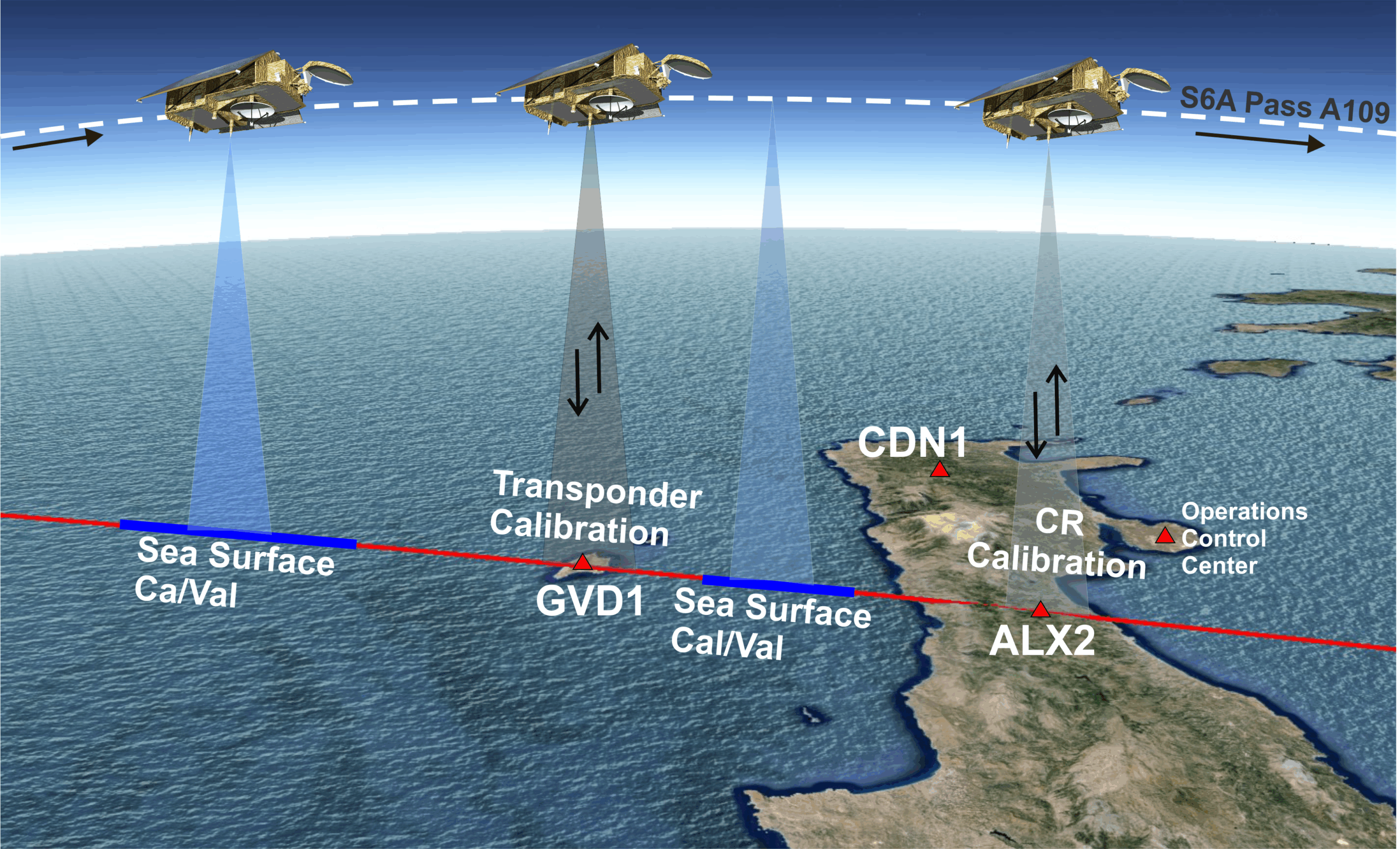
Transponder CAL/VAL
Microwave transponders (CDN1 in Crete and GVD1 in Cavdos) are active ground point targets to receive, amplify, and send back to the satellite the radar signal transmitted by the satellite. They work with single satellite pulses, Low Resolution, Synthetic Aperture Radar, and Fully-Focused SAR Mode. They calibrate range, time-tagging and sigma-0 altimeter observations.